Our dataset leverages Unreal Engine 5 to create physically accurate, multi-task ground truth for aerial remote sensing.
From densely populated cities to rural landscapes, we provide perfectly aligned RGB, depth, and segmentation masks.
10k+Frames
UE5Engine
Abstract
Recent advances in deep learning for remote sensing rely heavily on large annotated datasets, yet acquiring high-quality ground truth for geometric, radiometric, and multi-domain tasks remains costly and often infeasible. In particular, the lack of accurate depth annotations, controlled illumination variations, and multi-scale paired imagery limits progress in monocular depth estimation, domain adaptation, and super-resolution for aerial scenes. We present SyMTRS, a large-scale synthetic dataset generated using a high-fidelity urban simulation pipeline. The dataset provides high-resolution RGB aerial imagery (2048 × 2048), pixel-perfect depth maps, night-time counterparts for domain adaptation, and aligned low-resolution variants for super-resolution at ×2, ×4, and ×8 scales. Unlike existing remote sensing datasets that focus on a single task or modality, SyMTRS is designed as a unified multi-task benchmark enabling joint research in geometric understanding, cross-domain robustness, and resolution enhancement. We describe the dataset generation process, its statistical properties, and its positioning relative to existing benchmarks. SyMTRS aims to bridge critical gaps in remote sensing research by enabling controlled experiments with perfect geometric ground truth and consistent multi-domain supervision.
Task 01
Monocular Depth Estimation
We provide pixel-perfect depth ground truth exported directly from UE5. Below are interactive point cloud visualizations reconstructed from our monocular depth maps, showcasing the high-density architectural detail preserved in our captures.
Task 02
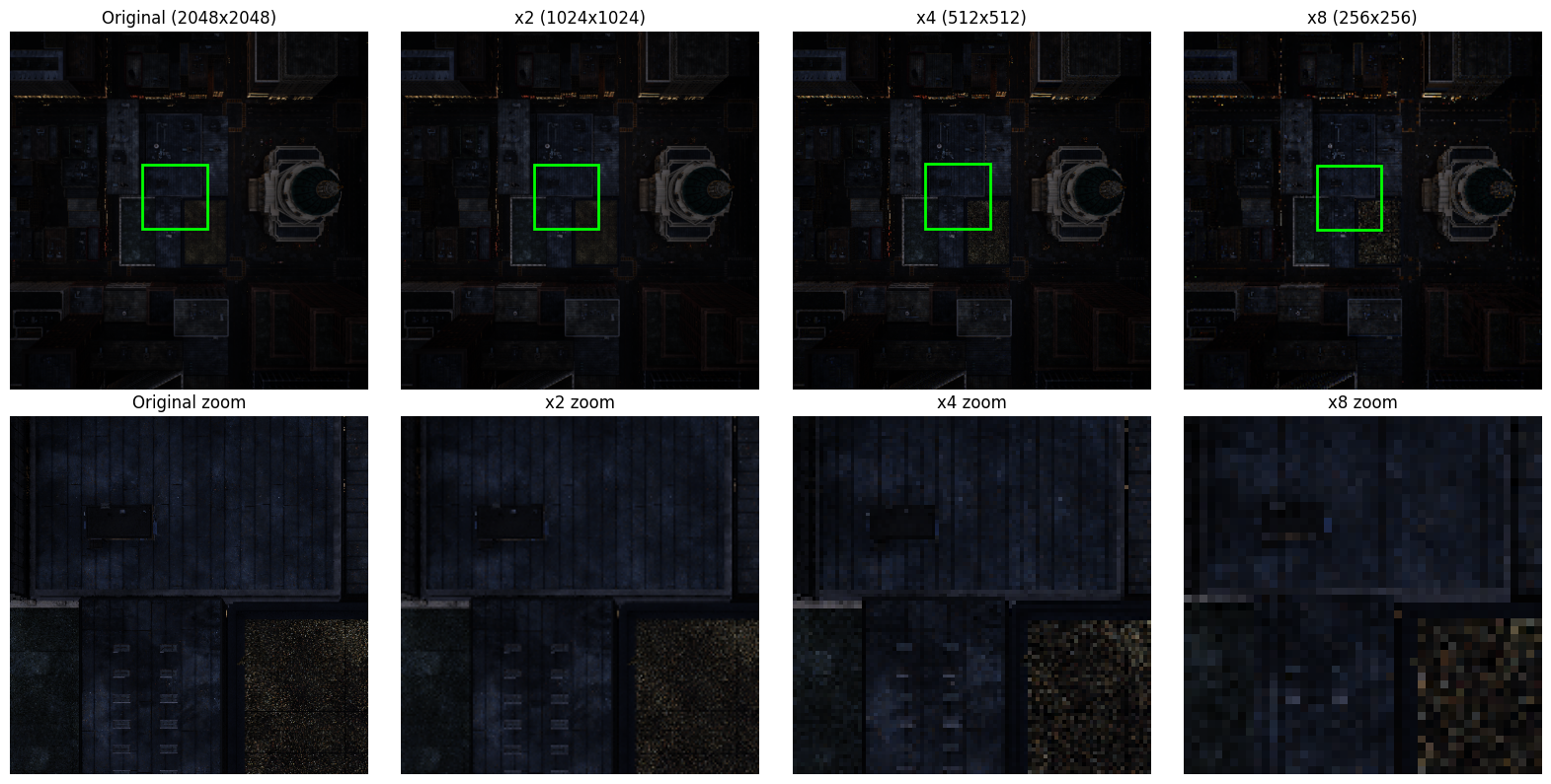
Super-Resolution (x2, x4, x8)
SyMTRS includes multi-scale paired imagery. Below is a full-resolution comparison showing the ground truth 2048x2048 RGB against various downsampled levels, optimized for training robust SR models.
Task 03
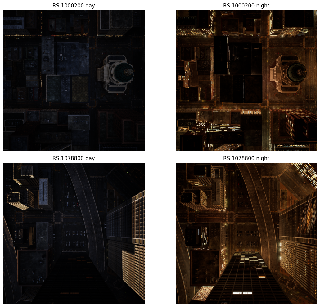
Domain Adaptation (Day to Night)
Enabling zero-overhead data generation for day-to-night translation. Our dataset features perfectly aligned imagery across divergent illumination cycles, critical for robust 24/7 autonomous monitoring.
Day to Night Generation
Full-Resolution Comparison
The MatrixCity simulation environment allows for deterministic camera placements with variable astrophysical time, facilitating the creation of large-scale domain adaptation benchmarks.
Active TaskSim-to-Real
Citation
If you use FusionVision in your research, please cite the following paper.
@misc{elghazoualisymtrs,
      title={SyMTRS: Benchmark Multi-Task Synthetic Dataset for Depth, Domain Adaptation and Super-Resolution in Aerial Imagery},
      author={Safouane El Ghazouali and Nicola Venturi and Michael Rueegsegger and Umberto Michelucci},
      year={2026},
      eprint={2604.21801},
      archivePrefix={arXiv},
      primaryClass={cs.CV},
      url={https://arxiv.org/abs/2604.21801},
}